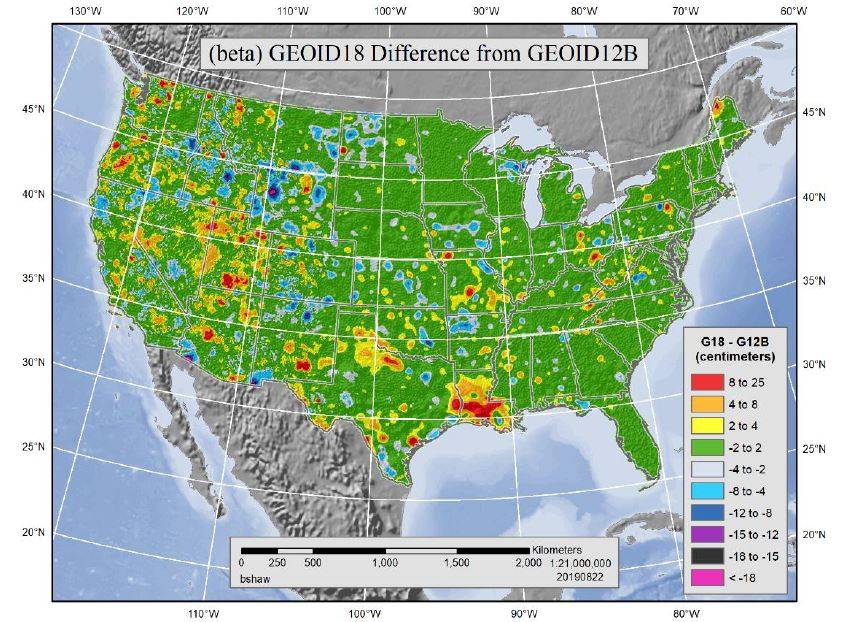
Now that the National Geodetic Survey has released the new Geoid18 model, you can now download and load it into GPS Pathfinder Office. There are a number of improvements over Geoid12B including advancements in digital elevation modeling techniques and better elevation data. There was also a 26% increase in the number of Bench Marks collected to improve the accuracy of the NAVD88 model while still being constrained to Geoid18, therefore increasing overall elevation accuracy.
Below, I have outlined the steps necessary to load Geoid18 into Pathfinder Office.
- Download Geoid18 (Conus) from this website
- This will be downloaded as g18us.ggf, save it to your desktop.
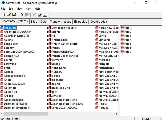
- Open the Coordinate System Manager program. This is a program that is automatically installed with Pathfinder Office.

- Click View > Options then copy and paste that directory file path into a new Windows Explorer window. Copy the Geoid18 .ggf you saved to your desktop into the list of the other .ggf files located at that file path.
- Go back to Coordinate System Manager, click Edit > Add Geoid Model.
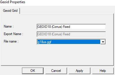
- Name the file GEOID18 (Conus) Fixed. The geoid name must ready exactly as the Export Name reads otherwise you will not see it in Pathfinder Office.
- Select the g18us.ggf file for your File Name selection. Click Apply > OK.

- Save your changes!!
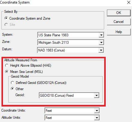
- Open Pathfinder Office > Options > Coordinate System. You should now see GEOID18 (Conus) Fixed as an option to select from for your MSL Geoid Models.

![[DEV] Seiler Geospatial Logo](https://dev.seilergeo.com/wp-content/uploads/sites/9/2022/05/SeilerGeospatial.png)

very helpful!